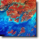
Město: Reino De Indafe, Region: Cacheu
|
Navigace mapy Celého Světa online: Kliknutím a tažením na mapě Celého světa, nebo použijte zoom kontrol.
Zeměpisná šířka: | 11,7833 (11°46'59.880"N) |
Zeměpisná délka: | -16,0667 (16°4'0.120"W) |
Nadmořská výška: | 29 m |
|
| |
|
|
|
|
Vzdálenost města Reino De Indafe do 18 největších měst státu: Guinea-Bissau
|
Přímá vzdálenost | Km |
| Reino De Indafe - Bissau | 53 km |
| Reino De Indafe - Bafata | 121 km |
| Reino De Indafe - Tombali | 89 km |
| Reino De Indafe - Bafata | 158 km |
| Reino De Indafe - Gabu | 209 km |
| Reino De Indafe - Bissoram | 83 km |
| Reino De Indafe - Bissora | 75 km |
| Reino De Indafe - Bolama | 69 km |
| Reino De Indafe - Cacheu | 55 km |
| Reino De Indafe - Bubaquer | 61 km |
| Reino De Indafe - Catio | 105 km |
| Reino De Indafe - Porto Mansoa | 88 km |
| Reino De Indafe - Buba | 118 km |
| Reino De Indafe - Quebo | 133 km |
| Reino De Indafe - Pinto | 32 km |
| Reino De Indafe - Farim | 120 km |
| Reino De Indafe - Quinhamel | 26 km |
| Reino De Indafe - Fulacunda | 98 km |
Vzdálenost města: Reino De Indafe do Top 10 měst světa
|
Přímá vzdálenost | Km |
| Reino De Indafe - Praha | 5 090 km |
| Reino De Indafe - Berlín | 5 239 km |
| Reino De Indafe - Londýn | 4 647 km |
| Reino De Indafe - Los Angeles | 10 372 km |
| Reino De Indafe - Moskva | 6 710 km |
| Reino De Indafe - New York | 6 473 km |
| Reino De Indafe - Paříž | 4 461 km |
| Reino De Indafe - Peking | 12 464 km |
| Reino De Indafe - Rio De Janeiro | 4 862 km |
| Reino De Indafe - Sydney | 17 244 km |
| Reino De Indafe - Tokio | 14 161 km |
Podpořte nás ·
Kontakt·
Kniha návštěv ·
RoboStav
Copyright (c) 2026 by CELÝSVĚT. Všechna práva vyhrazena!
Kontaktní e-mail: celysvet(zav)email.cz


